
By Madeleine Muzdakis on July 13, 2024
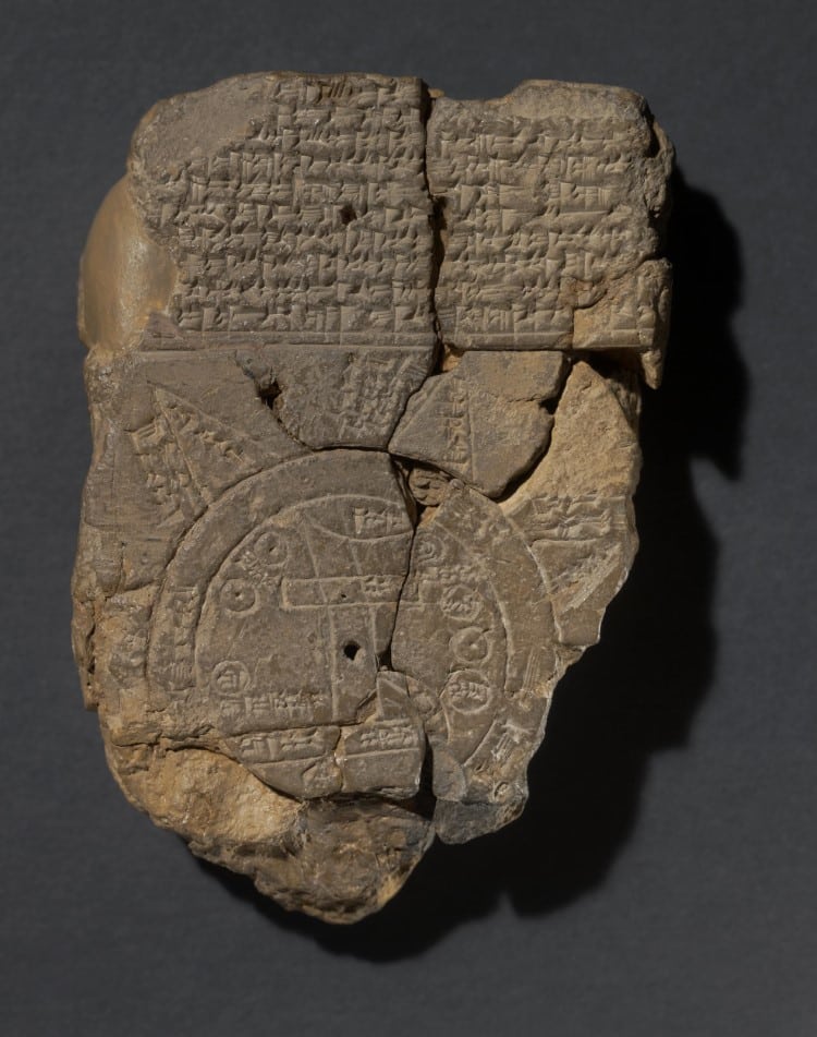 Photo: © The Trustees of the British Museum, CC BY-SA 4.0
Researchers have been able to decode the text and the meaning of the map’s symbols, which are accompanied by text.
How a society records the world, depicting its known boundaries and contents, says a lot about belief systems, science, and more. For example, the ancient Hereford Mappa Mundi was drawn in 1300 and depicts the world through a medieval Biblical lens. Or there is a surprisingly accurate crowd-sourced world map created by a Venetian monk in the 15th century. There are also the 12th-century renditions of Muhammad al-Idrisi, an intrepid scholar and traveler. But the oldest map of the known world was not made on vellum or in Europe. It was actually carved in clay and preserved 2,600 years ago in what is now known as The Babylonian Map of the World or Imago Mundi.
Legendary archeologist Hormuzd Rassam discovered the fragment of a clay tablet bearing the map in the 19th century within what is today Iraq. The British Museum acquired it in 1882, and it is still part of the museum’s collection. According to the museum, the schematic map is from the late Babylonian period and dates to roughly the 6th century BCE.
It features text in cuneiform script, as well as a sun-shaped drawing with mysterious incisions. Part of the drawing has broken away over time. But researchers have been able to decode the text and the meaning of the map’s symbols, which are accompanied by text. The outer circle (numbers 14 to 17 in the schematic below) is the bitter or salty water, meaning the ocean. Babylon is number 13, right below a tall mountain. It appears the Euphrates cuts a channel through the city, marking its central place in ancient Near Eastern civilization.[…]
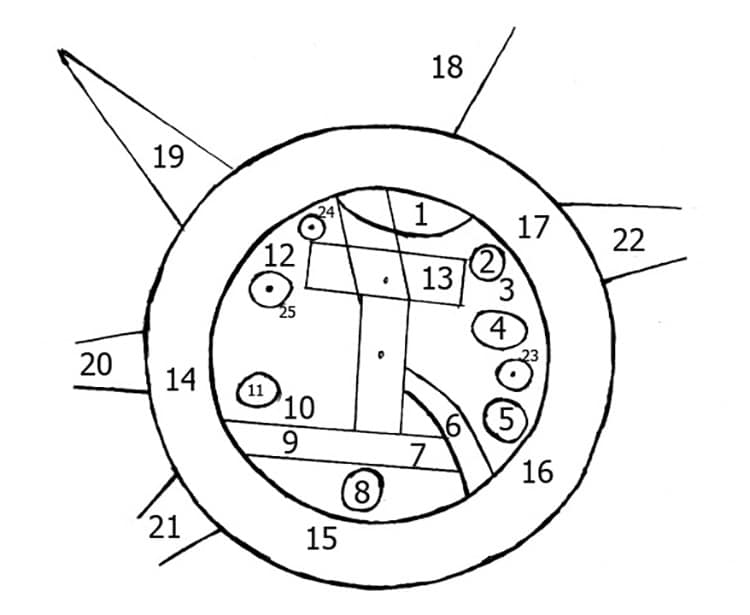 A schematic of the map, showing for example at 7 a swamp, at 2 a city, and at 1 a mountain. (Photo: Wikimedia Commons, Public Domain)
More: Explore the Oldest Existing World Map, Carved in Clay 2,600 Years Ago
