
 This is an ingeniously different way of looking at our planet.
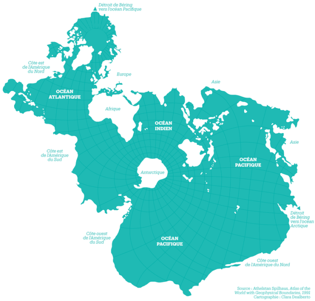
When you imagine a world map, what do you see? Most likely, you picture the Mercator Projection, a rendering rooted in the 16th century. While this visual remains the most widely-used and universally accepted view, its proportions and overall orientation are not accurate. To remedy this, contemporary cartographers and designers alike have created new maps of the world, from an origami-inspired plan to a “true size” version. Though popular today, this phenomenon is not entirely new, as made apparent by the Spilhaus Projection.
This unique map was drafted in 1942 by South African-American geophysicist, oceanographer, inventor, and urban designer Athelstan Spilhaus. It ingeniously places the oceans in the center, resulting in a view that visually unites the bodies of water and transforms the landmasses into negative space. This approach results in an eye-catching map that, for once, takes the cartographical emphasis off of countries.
Source: Fascinating Map From 1942 Features Oceans as Main Focus of theWorld
